by Timo Niemann
### Task1 #### 1.1 See code `lab_5.m` and `create_satellite_sim.m`, where the first file defines all parameters for the simulation and the create_satellite_sim function creates and returns the satellite and ground station. #### 1.2 To calculate the distance to the satellite, the MATLAB access analysis example was used as a basis and modified. The distance is calculated with the `aer` function, which returns azimuth, elevation, and slant range between the ground station and the satellite. To avoid invalid channel simulations, the signal-based estimation step is skipped when the Doppler shift `fshift` is non-finite. 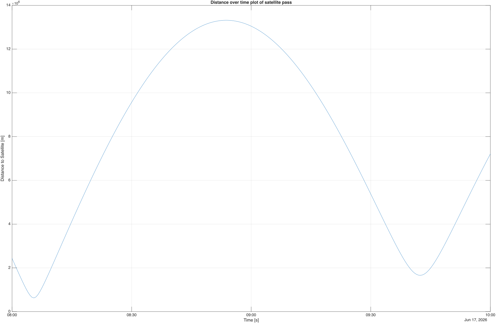 The first satellite flyby occurs at around 08:05:30. During the pass, the distance first decreases as the satellite approaches the ground station and then increases again after the closest approach. Around 08:53:30 to 08:54:00, the distance reaches a maximum because the satellite is on the far side of its orbit relative to the ground station. The second pass occurs at around 09:42. Its minimum distance is larger than during the first pass because Earth's rotation changes the relative position of the ground station below the satellite orbit. #### 1.3 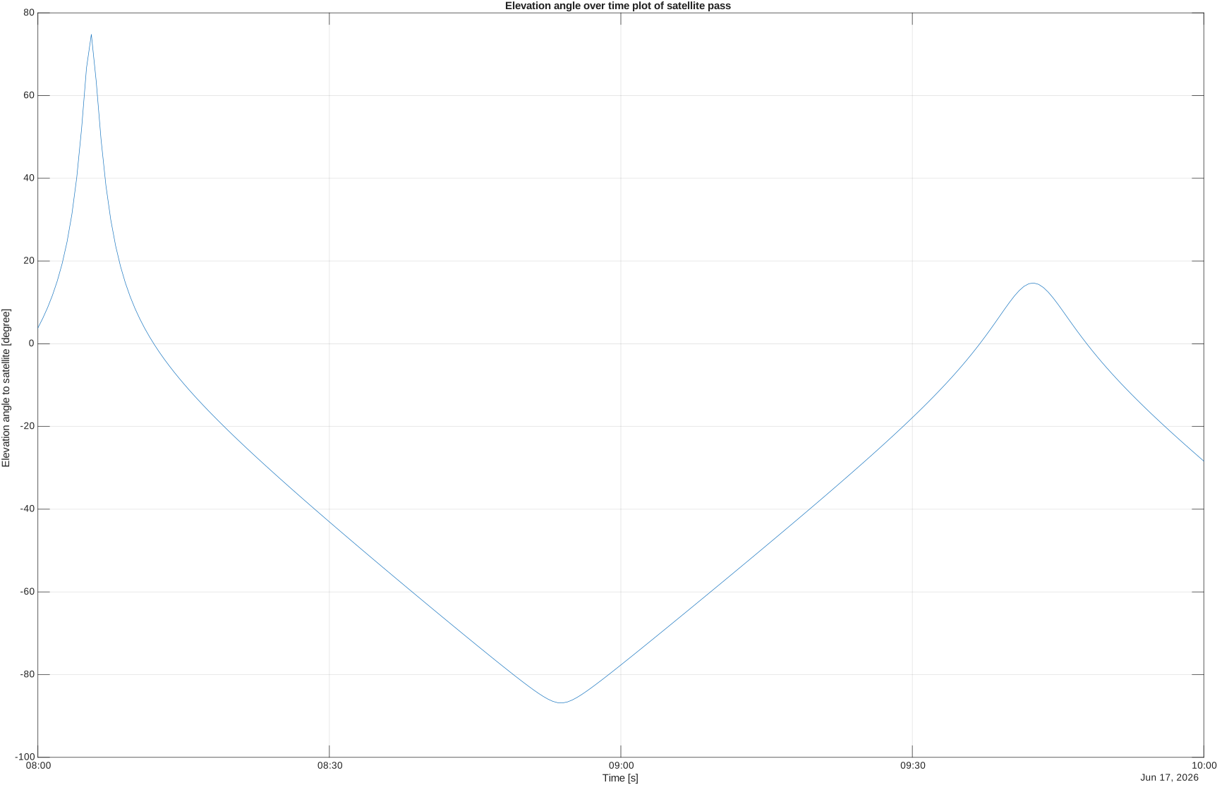 As in the distance plot, the elevation angle reaches its highest value during the first pass. The second pass has a lower maximum elevation because Earth's rotation shifts the ground station relative to the satellite ground track.